. . . Fresh Field Verification Reopens C/River’s Oil, Maritime Claims
By Princewill Kingston/Solomon Okon
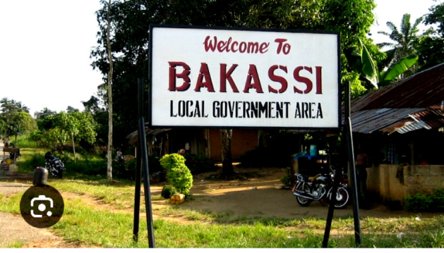
Nearly two decades after the controversial transfer of the Bakassi Peninsula to Cameroon, a new technical development has rekindled hope in Cross River State and among the indigenous people of Bakassi.
Issues surrounding the ancestral homeland of the Bakassi people and the State’s lost maritime resources may receive positive attention.
This followed the decision of the Revenue Mobilisation Allocation and Fiscal Commission (RMAFC) to reopen the verification of disputed and newly drilled oil and gas wells, after complaints, counterclaims and disagreements over the coordinates used in an earlier exercise.
On September 16, 2026, RMAFC inaugurated a reconstituted Inter-Agency Technical Committee to undertake a fresh verification of disputed and newly drilled oil and gas wells from 2017 to date.
The committee comprises technical officials from RMAFC, the Office of the Surveyor-General of the Federation, the National Boundary Commission and the Nigerian Upstream Regulatory Commission.
According to RMAFC, the new exercise will verify coordinates, accurately plot them on approved maps and, where necessary, conduct physical field verification. For Cross River, the development could prove significant.
The Bakassi Connection
Following the 2002 judgment of the International Court of Justice (ICJ), and subsequent implementation of the Green Tree Agreement, Nigeria transferred Bakassi Peninsula to Cameroon in 2008 amidst agony particularly from the native Efik people who never wanted to be addressed as Cameroonians.
Cross River, which bore much of the consequences of the transfer, has since maintained that it suffered enormous economic and social losses.
Communities were displaced, livelihoods were disrupted and the state was said to have lost access to territory and maritime resources that had historically been associated with the people of the area.
The renewed technical process has consequently generated expectations that some of the resource questions arising from the Bakassi saga could now be examined using modern geographical and scientific evidence.
Old Maps, New Technology
One of the most interesting aspects of the renewed exercise is the emphasis on actual coordinates, approved maps and physical verification.
A recent report in The Guardian quoted experts who argued that modern satellite geodesy, hydrographic surveys and bathymetric mapping can provide more detailed evidence about maritime geography than was available during earlier proceedings.
The report also said the re-engagement of Surveyors-General as observers could give Cross River an opportunity to formally present its geological and hydrographic evidence for consideration and preservation.
For indigenous Bakassi people, this is important because it introduces another dimension into a controversy that has largely been viewed through the prism of historical treaties, maps, court judgments and diplomatic agreements.
The Oil Wells Saga
At the heart of the latest controversy is the question of where disputed oil and gas wells are actually located.
A January 2026 statement by the Cross River State government said it had presented evidence concerning 245 oil wells, and maintained that the State has oil-producing assets within its maritime territory.
The State also argued that it had lost resources following the transfer of Bakassi and questioned why oil wells associated with the disputed area should be attributed to the neighbouring Akwa Ibom State.
An earlier Inter-Agency Technical Committee report examined disputed and newly drilled wells and was tasked with physically verifying coordinates and plotting them on approved maps.
However, RMAFC has now made clear that the previous draft report was discarded following complaints and counterclaims from States. That means the matter is once again open for technical examination.
A Second Chance for Cross River?
A former Surveyor-General of Cross River State, who preferred anonymity, told our reporter that the new NBC policy offers an opportunity to correct the anomaly which deprived the State of its resources.
“What the ICJ did not consider was the hydrography and geology. The sedimentation of the Cross River Estuary, the bathymetry of the Calabar Channel and the offshore morphology all point to Bakassi as a continuation of the Cross River.
“Now that field verification is back, we can lay this evidence on the table for formal recording and acceptance,” he said.
Our source, who is the professor of Geoinformatics at the University of Calabar, said advances in surveying have made the State’s case even stronger than it was in 2002.
“Today we have satellite geodesy, LiDAR and high-resolution bathymetric mapping. We can now scientifically prove territorial continuity beyond archival maps. The presence of State Surveyors-General means you can now challenge coordinates on the ground. That is a major shift,” he noted.
The renewed technical window is coming at a time when displaced Bakassi indigenes are still battling poor resettlement and loss of livelihoods.
Sources at the State Boundary Commission said a strong scientific submission would not only preserve Cross River’s claim for posterity but also strengthen its demand for increased federal support and international attention for the displaced population.
PillarToday reliably gathered that the state government may soon constitute a technical team of surveyors, hydrographers, historians and international law experts to compile the evidence.
Corroborating, an official of the Ministry of Lands and Survey, who gave his name simply as Eteng, said the state intends to leverage the process to ensure its position is “properly documented for posterity and justice.”
He noted that the purpose of the RMAFC exercise is to ensure that oil and gas production is correctly attributed to the States entitled to derivation revenue, based on verified locations and established boundaries.
“If modern technical verification produces evidence that changes the understanding of where particular oil and gas assets are situated, the findings could have important consequences for Cross River’s continuing argument over its maritime status and resource entitlement,” he noted further.
He lauded Gov Bassey Otu for doing everything within his powers to bringing the matter to limelight.
And What About the Displaced Bakassi People?
For the indigenous people of Bakassi, however, the central issue is bigger than oil money. It is about justice, identity, ancestral homeland and livelihood.
The transfer of Bakassi created a generation of people whose relationship with their traditional homeland was fundamentally altered. A recent report on the renewed Cross River campaign noted continuing resettlement and livelihood challenges among displaced communities.
Experts had advised that any renewed examination of Bakassi should not focus exclusively on oil wells and revenue allocation but that the welfare and rights of the indigenous people must remain part of the conversation.
A Window Has Opened
The latest development therefore presents Cross River with an opportunity. The State will need to present its claims through properly documented scientific, geographical, historical and legal evidence.
It will also have to distinguish carefully between issues concerning the international boundary with Cameroon and the separate question of the allocation of offshore oil resources among Nigerian states.
The Road Ahead
Checks indicated that many Nigerians believe that the Bakassi story is far from over. For years, the people of Bakassi have carried the consequences of decisions made in international courts and diplomatic negotiations.
Now, with the federal government returning to physical verification and modern technical mapping, a new chapter appears to be opening.
Whether that chapter ultimately leads to changes in resource allocation, stronger recognition of Cross River’s maritime claims, greater federal support for displaced Bakassi communities or simply a more accurate historical record remains to be seen.
But one thing is clear: The renewed survey has brought the Bakassi question back into serious technical discussion.
And for the indigenous people who have waited for years for their grievances to receive fresh attention, that development has rekindled an enduring hope that justice, whatever form it eventually takes, may yet emerge from facts established on the ground and at sea.